Then off -- it's half past five in the evening, 15 degrees below zero and little snow. The moon shines brightly, the carriage through the gate creaking. Small piles of Poles stand in the street, but they don't say a word.1
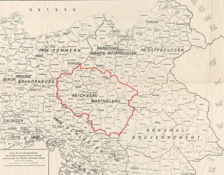
The Reichsgau Wartheland, also known as Warthegau, was a Nazi administrative district in occupied Poland that existed from 1939 to 1945. The Reichsgau was in large parts congruent with the historical landscape of Wielkopolska and had 4.5 million inhabitants. The capital was today's Poznań.
The almost six-year occupation period was characterized by the brutal persecution and murder of the Polish and Jewish population on the one hand and the targeted resettlement of German-speaking parts of the population on the other.
Image: „Map of the administrative division of the German Eastern Territories and the General Government of the occupied Polish territories as of March 1940“. Herder Institute for Historical Research on East Central Europe – Institute of the Leibniz Association, map collection, inventory no. K 32 II L 43, edited by Copernico (2022). CC0 1.0.
Part of the von Campenhausen family estate is preserved in the document collection of the Herder Institute. This includes a 19-page typewritten account of the escape. Irmela von Manteuffel provides information in the report about its creation: based on handwritten notes, she wrote the report in early March 1945, when they had arrived in Hesse (cf. entry about the period from March 1 to March 9, 1945). Since the original notes have not survived, it is not possible to say with certainty whether Irmela von Manteuffel may have subsequently intervened in the content of the report. In addition, numerous letters and postcards from Adline von Campenhausen and her relatives have survived, which were sent before, during and after the escape.
When a[nd] how will peace break out? Or is the war still stamping its way through all of Ger[many]?2


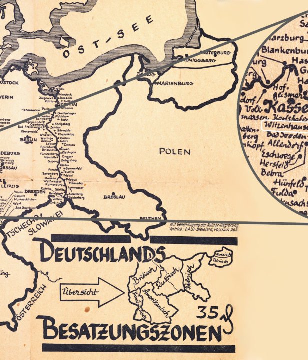
Map material from the Herder Institute
Selection of sources and analysis: Christian Lotz
Map montages: Laura Gockert


